
The 20km Trek
(It’s a been too long since I did a long one…)
There’s a young couple who keep their horses at the farm. They’re seriously into endurance riding – in the past, I have referred to them as Monsieur and Madame Endurance. Madame was short-listed for the French team for WEG this year and Monsieur’s horse is just about to go international – he’s doing a 200km two-day ride in Barcelona this weekend. Anyhow, they are so committed to their sport that they have sussed out loads and loads of trails around our area. They had told MC that there’s a nice 20km loop just the other side of Vachères, which is only a couple of kilometres from the farm.
Let’s do it, we said.
We looked at maps beforehand and had a very vague, fuzzy notion of where to go. However, Monsieur Endurance had also given MC incredibly detailed directions, which she had carefully noted down. Which was a very good thing indeed – if not for those directions, I think we’d still be riding around between Vachères, Simiane la Rotonde and Banon, two weeks later.
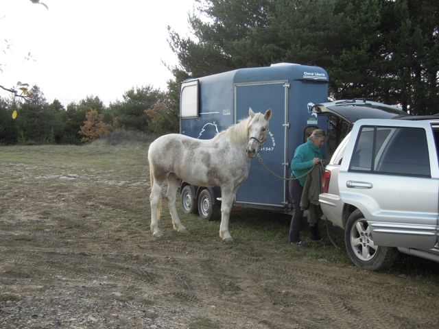
We decided to trailer the horses to the start point – well, a couple of kilometres is an hour by horse, as opposed to a few minutes by jeep and trailer! The plan was for four to five hours of riding, not six or seven (I think that would have killed both of us).
We found the car park described by Monsieur Endurance – on a bend, used by hunters. Loads of room for a jeep and trailer.
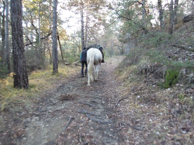
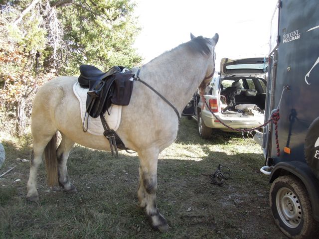 Flurry and Quieto were very calm as we tacked them up.
 MC uses front hoof boots on Quieto – his horrible crack is still growing out – but I decided to go barefoot with Flurry. The Endurances had said the trails were good all the way around… but I always forget that their horses are shod and we have different opinions as to what constitutes ‘good.’
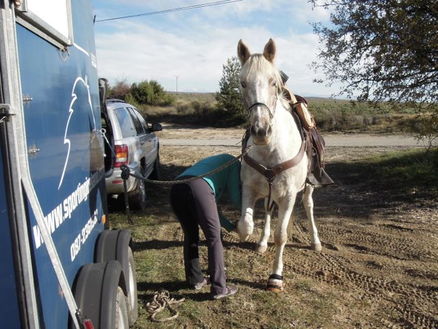
We led the horses for the first bit, along the road – this allows their back muscles to warm up before their rider gets on board.
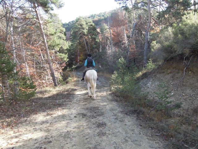
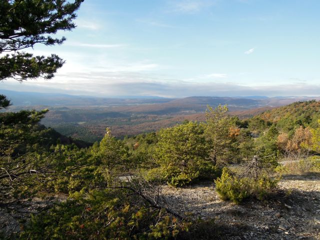
 We were quite high up, but the views were sporadic and mostly obscured by trees. Literally, I couldn’t see the woods for the trees!
The view towards Simiane-La_Rotonde
After about half a kilometre, we turned off the road onto a very stony forest trail and I was already regretting my decision not to use hoof boots. I stayed on foot and hoped that the surface would improve, which it did – eventually. We went from stones to deep, slippery mud, with massive puddles – but at least the horses were more comfortable on it.
 Down and down and down we went, the trail weaving back and forth against the side of the hill, landmarks passing by precisely as described by Monsieur Endurance. Finally we seemed to be on the valley floor. We would have to pass through a field of ponies, through the gates of an electric fence. Around a corner we went, and there it was, a strand of wire across our path.
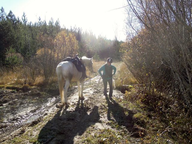
MC closing the wire behind us
No ponies to be seen, though – I guess they had been taken off the field because it was so wet.
“30 metres after the second gate, there’s a rough trail to the right, with branches cut down all over it.”
Sure enough, there it was. Now we were to follow an almost straight line northwards until we rejoined the road.
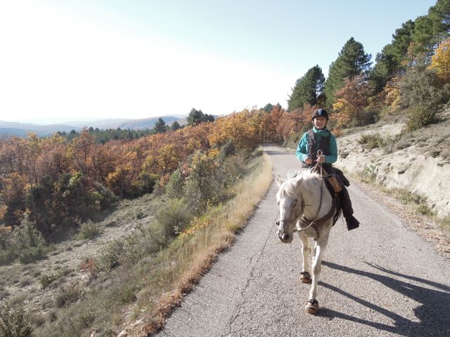
This section seemed to pass incredibly fast. I tried to figure out where we were on my map and got it completely wrong, as I learned later. This is why I was really glad we had those brilliant directions! We came out onto the road in what seemed like no time, and stayed on it for almost 2km.
 We were starting to climb back up the hill again and the views across the valley were briefly unobscured.
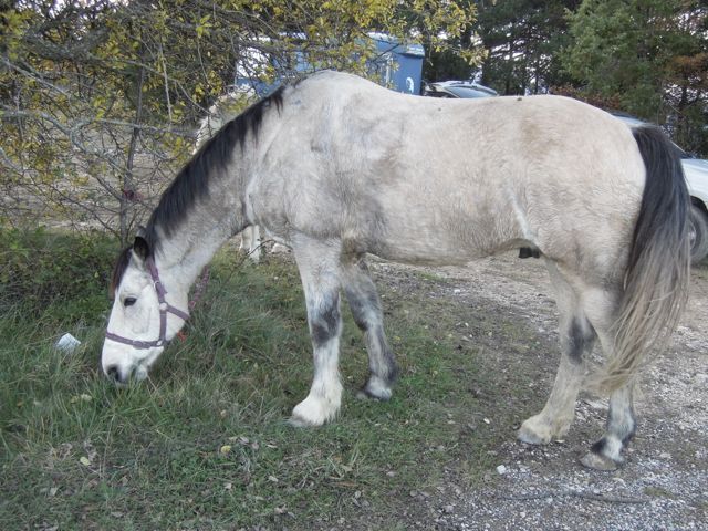
 The next landmark was a big open area beside a water storage tank (borne). We decided that this was a good place for a picnic, so we stopped and ate, while the horses grazed.
“Take the rightmost trail from the borne” – but we were puzzled. The rightmost trail seemed to go straight back onto the road? We agreed that a phone call was in order. Yes indeed, Monsieur Endurance said, that’s the one. It swings away from the road and back around the hill, he said.
It was a wise decision to make that call. I’m pretty sure we’d have taken the wrong trail without his reassurance. The trail descended for a short distance and then we were climbing in earnest. The surface was good and Flurry felt great, striding along happily. An hour later, we found ourselves emerging onto a road we were both familiar with. Turning right would have brought us back towards Vachères, but the instructions were to turn left and then take a right onto a steep track through the woods on the other side.
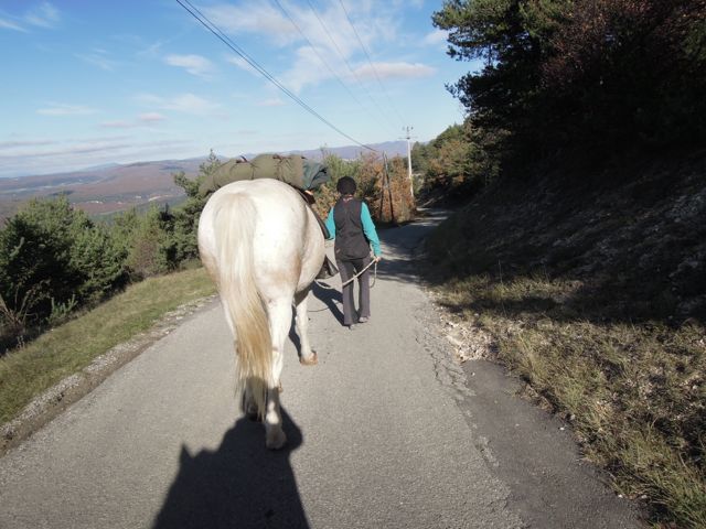
“I need to walk,” I said, and we both dismounted. I reckon we walked for a good two or three kilometres, and I think that walk saved me from extreme stiffness the next day.
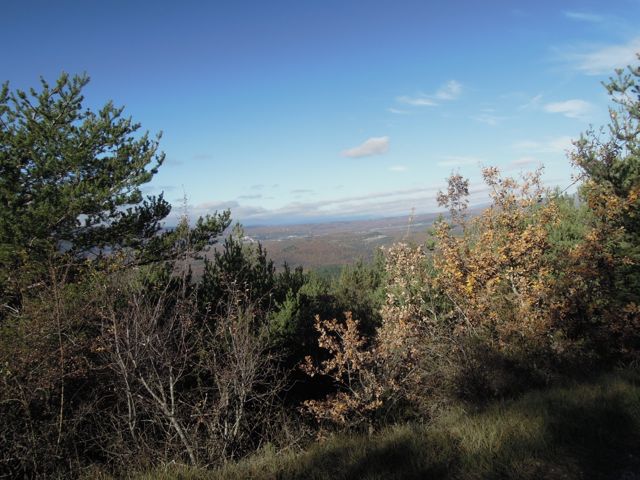
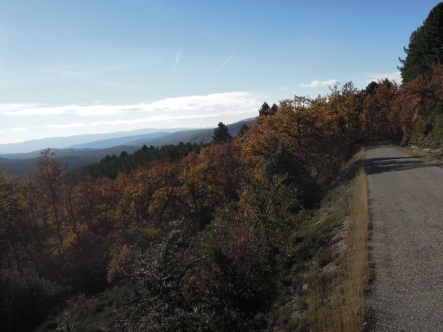
 There were beautiful views from the top of the ridge, looking towards Mont Ventoux (lost in the gloom) on one side :
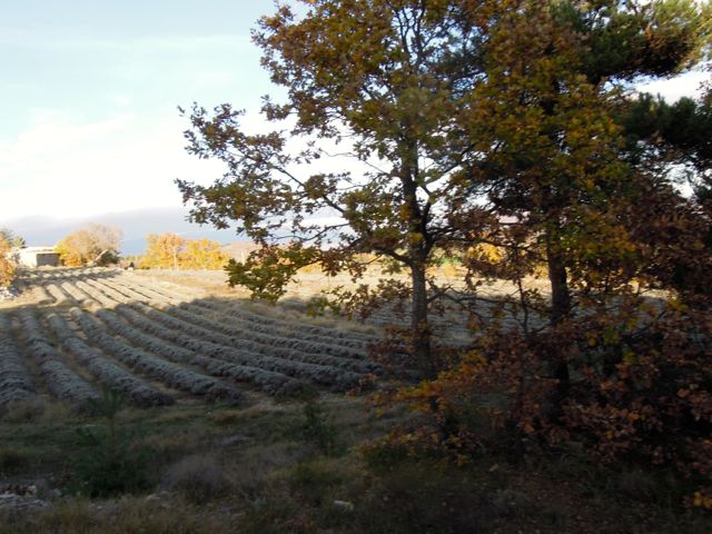
and the Alps on the other (the smudge on the horizon is the Alps, I swear!) :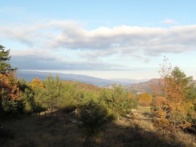 We crossed the road again and passed through a plantation of sweet chestnuts and then followed a track along the top of the hill from which our descent had started. Of course there was a lavender field en route!
The trail became more and more stony and I felt Flurry was getting a bit tender in his feet. Enough, I thought, I’ll dismount and leave him pick his way along without my weight on his back. MC took to her feet as well but, as it turned out, we were only fifty metres or so from the trailer! Still, it’s always a good thing to walk for the last section – it allows the horse’s back start to cool off.
Neither horse was particularly sweaty. This really surprised and pleased me in Flurry’s case. He usually sweats easily, but I think we had paced ourselves well enough that he wasn’t at all stressed by the long ride.
I didn’t use my phone to map the route – my battery was a bit low and I didn’t want to risk it. Here’s the IGN map(s) with the route marked out on it (of course our trail spanned the join in two maps!) This image should be good enough quality that you can zoom in if you want to. We started out at about 830 metres and dropped to 520 metres, then climbed up to 800, with a gradual climb back to 830 along the last ridge.
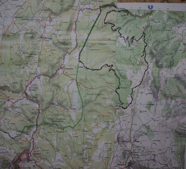
I have to say it doesn’t look like 20km on the map, but who am I to argue with the Endurances.
For all who are interested, Flurry’s bloods came back showing that there’s nothing untoward going on with his kidneys. Good news and bad news, I guess.
PS Friday December 5th is the last day of voting for the HayNet Blogger of the Year Award. If you haven’t already done so, can you pop over there and vote for Tails From Provence? (They mis-spelt Tails, but they’re a nice bunch so I’ll forgive them) CLICK HERE TO VOTE!


